|
|
Catalog Search Support |

| The cemetery in Lime
Rock, located on Route 112 opposite the Outfield Entrance of
Lime Rock
Park, and across Dugway Road from
Trinity Church, is
a separate entity from Trinity Church, and is managed by the Lime Rock
Cemetery Association, who do so for the Town of Salisbury, which owns the
ground. Notwithstanding the organizational separation, there are close
historic, personal and organizational ties between the church and the
cemetery, not the least of which are the Trinity parishioners who are
buried here. Interestingly, this is not the original Lime Rock cemetery. The distinction of being first, however, has been eclipsed by the removal of the original cemetery, which was located around a mile west of the present cemetery, with re-burial in this cemetery many years ago. |
|||
Lime Rock Cemetery Plot MapWe were able to obtain at auction an original map of the Lime Rock Cemetery. As far as we know, the download we offer of our photo and scans of this map represent the only plot maps of this cemetery that are publicly available, although, of course, the Cemetery Association has working maps that permit them to manage sales of plots and niches in the columbarium. Please note the following about this map: First, the map is “as found”. It had been used extensively before we acquired it at auction from a dealer who had in turn acquired it in an estate sale, and shows considerable wear. Some names are illegible on the scans (as they are on the original map) and some are unreadable due to the tape that an earlier owner had applied. We have not attempted to restore the map. Second, the size of the map makes it a difficult item to present as a download. What we are presenting here is, first, a photograph of the overall map, which is approximately 30 inches long in its longest dimension, followed by eight scans of portions of the map. The initial photograph should permit the viewer to orient the following scans in terms of location within the cemetery. The scans were done at sufficient resolution to permit extensive use of magnification capabilities in whatever PDF reader you may choose to use in viewing the map. We cannot guarantee perfection; all we can promise is that with this map you will have information that is not otherwise available. Third, please understand that this map does NOT represent the current status of burials in the Lime Rock Cemetery. While the map clearly was used at some point in its history to record the sale of plots and the locations of individual burials within them to some extent, it is not current. It has some notable quirks. We offer it as a download of 11 pages, including one photograph and eight high-resolution scans, in PDF format, for $4.25. |
|||
What's Lime Rock Cemetery like?People ask this question frequently, especially people who live a long distance from Lime Rock. They're glad to see photos of individual headstones, of course, but questions about the overall setting -- and particularly the columbarium (an increasingly popular alternative for many people today) -- frequently come up. How to help? Jeff Silvernale was able to enlist the services of Root Tree Service to provide an aerial bucket for photographic services, so here we present some pictures, both from ground level and above, of Lime Rock Cemetery, and particularly of the columbarium. Click on any of these pictures to see a larger image. |
|||
 Lime Rock Cemetery, with Trinity Church in upper center, and columbarium at lower right. |
 The columbarium, seen from above |
 A closer view of the columbarium |
 Same vantage point, but looking toward Lime Rock Park, across the road |
 Entering the columbarium |
 In the columbarium, looking toward the back of the cemetery |
 Trinity Church in background, sun dial in columbarium in foreground |
 A view from inside the columbarium, Trinity Church in the background |
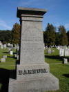
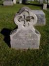
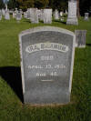
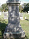
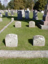
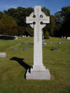
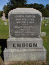
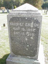
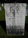
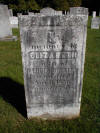
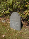
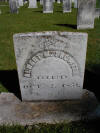
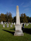
Monuments at Lime Rock Cemetery:
In response to several
requests, we are happy to provide here photographs of a few of the
monuments in the Lime Rock Cemetery. Those initially shown are both
from families with historically close ties to the parish and stones that
simply caught the webmaster's eye while wandering through the cemetery.
Please click the button to
Please note
that additional stones appear on the Lime Rock: an Illustrated Walking
Tour CD-ROM.
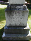
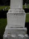
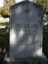
Click on any of these thumbnails to see a larger picture. |
|||
Barnum family stones: |
|||
 |
 |
 |
 |
 |
 |
 |
 |
 |
|||
Richardson family stones: |
|||
 |
 |
 |
 |
 |
 |
 |
 |
 |
 |
 |
 |
 |
 |
||
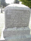
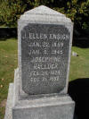
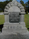
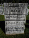
Goodwin and Ensign family stones: |
|||
 |
 |
 |
 |
 |
 |
 |
 |
 |
 |
 |
 |
 |
 |
||
Beckley family stones: |
|||
 |
|||
Bethke plaque in the columbarium: |
|||
 |
|||
Brown family stones: |
|||
 |
 |
||
Campbell family stone: |
|||
 |
|||
Cimino family stone: |
|||
 |
|||
Crowell family stone: |
|||
 |
|||
Kernickerbacker stone: |
|||
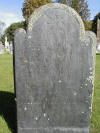 Note that this is believed to be the oldest stone in Lime Rock Cemetery. |
|||
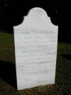
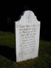
Kuhn family stones: |
|||
 |
 |
||
Patterson family stone: |
|||
 |
|||
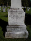
Pierce family stones: |
|||
 |
 |
 |
 |
Silvernale plaque in the columbarium: |
|||
 |
|||
Tellerday stone: |
|||
 |
|||
Washburn stone: |
|||
 |
|||
![]() to return to the Lime Rock page
to return to the Lime Rock page
|
|
||
|
Find us on Facebook |
|
Between the Lakes Group is located at 372 Between the Lakes Road, in Salisbury, Litchfield County, Connecticut. More specifically, we're in Taconic -- a hamlet in the Twin Lakes area of the Town of Salisbury. Questions about us or about our products? Go to our Frequently Asked Questions page. |